Introduction
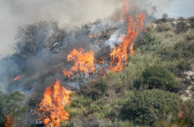
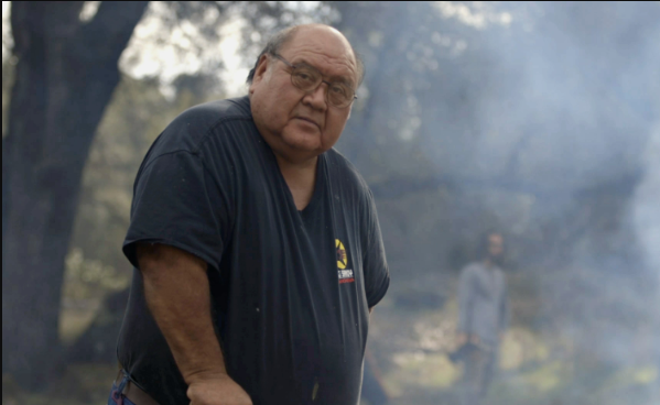
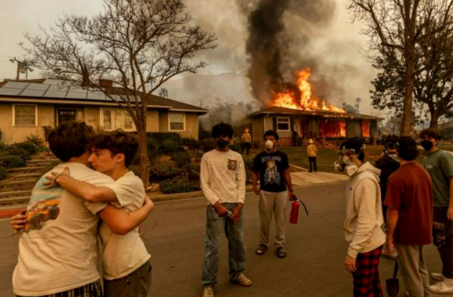
Residents of the Pacific Palisades region stared out their windows in disbelief. Where earlier that morning their hillside homes were surrounded by songbirds flitting across clear blue skies, they were now faced with angry red clouds of smoke driven by hurricane-force winds that whipped white-hot embers into palm trees, roofs, and parched yards. The lucky had enough time to drag out a garden hose to douse their roof, while the less fortunate grabbed passports, the dog, and a change of clothes before fleeing the raging inferno sweeping down the mountainside behind them.
Later that night in hotels and disaster shelters, how many of the displaced would think “how could this happen?”; and more importantly, how many would stop to consider the true implications of that question.
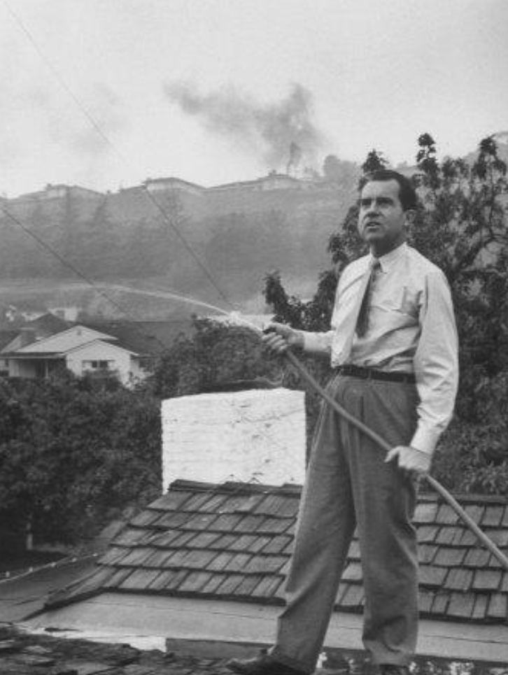
But who exactly were the Californians carrying out this interrogation? Was it millionaire Fredrick Rindge, after his entire Malibu Canyon ranch burned down in the great fire of 1903? Or was it County Supervisor Wright, his nerves shaken by a visit to the collapsing Palisades fire lines in 1930? Certainly, similar thoughts were voiced by Vice President Richard Nixon as he hosed down the roof of his rental home during the 1961 Bel Air wildfire.
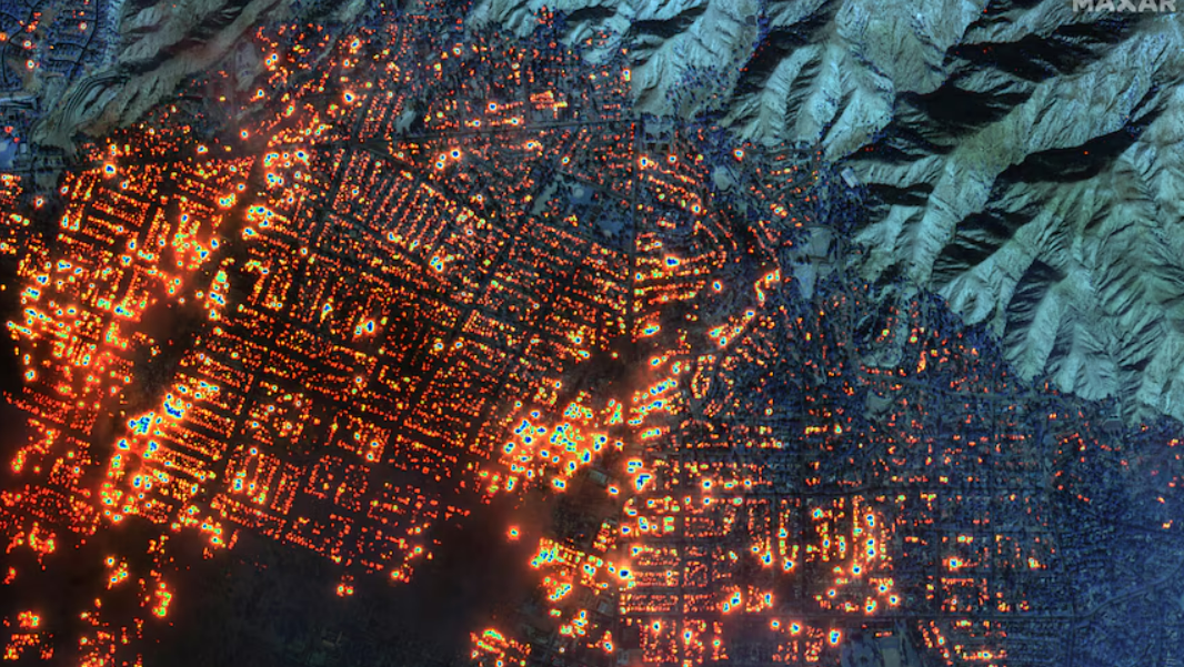
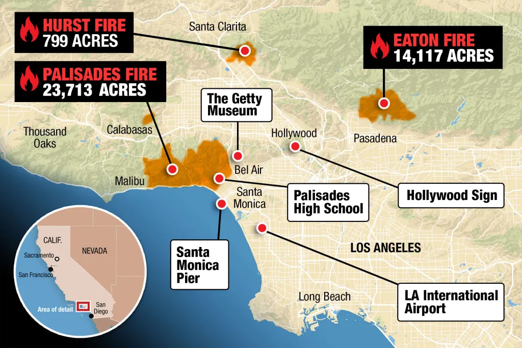
Now in 2025, a spate of wildfires have displaced 100,000 people throughout the Palisades, Altadena, and Eaton regions, and have been dubbed a “perfect storm”, a “catastrophic disaster”, and an “unfathomable tragedy”. Yet this time, many are asking a different type of question than during fires past; why had the fifth largest economy in the world once again allowed itself to stumble into a series of entirely predictable, and therefore preventable, disasters?
How Fires Spread
A Brief Geography Lesson
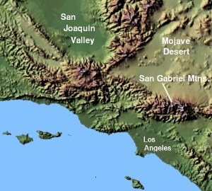
Greater Los Angeles is one of the world’s largest metropolitan areas, with the majority of its 18 million residents sprawled across a basin in Southern California adjacent to the Pacific Ocean in the west, and extending partly through the Santa Monica Mountains and north into the San Fernando Valley, with LA proper bordering the San Gabriel Valley to its east. This specific mountain range is like no other, in that one can hardly imagine the number of businesses, houses, and roads that twist through this range nestled in the towering crags of the Rockies or Himalayas.
While the Santa Monica Mountains don’t pose any danger from extreme cold or treacherous heights, there instead lurks the peril of the dry, gusty fires that periodically rip through the area and spread all the way down to the coast. In fact, the entire surface area of the Santa Monica Mountains has been burnt three times over the twentieth century, and there are individual patches of coastline or mountain, especially between Point Dume and Tuna Canyon, that have been incinerated as many as eight times since 1930.
Fire Funnels
The region’s extraordinary fire hazard is primarily shaped by the uncanny alignment of its coastal canyons with the annual “fire winds” from the north; the notorious Santa Anas, which blow primarily between Labor Day and Thanksgiving, just before the first rains. Born from high-pressure areas over the Great Basin and Colorado Plateau, the Santa Anas become hot and dry as they descend avalanche-like into Southern California. The San Fernando Valley acts as a giant bellows, sometimes fanning the Santa Anas to hurricane velocity as they roar seaward through the narrow canyons and rugged defiles of the Santa Monica Mountains.
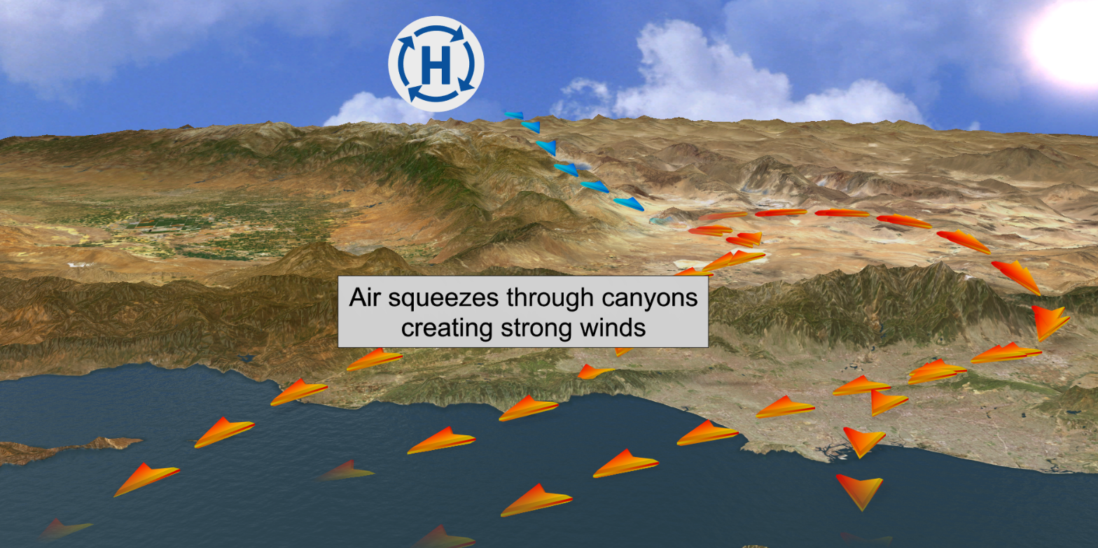
Sidebar: Fluid Dynamics Canyons effect the flow of air through them with several different mechanisms, two of which are primarily responsible for the massive increases of wind velocity seen in the Santa Monica mountains.
- Canyons act like natural wind tunnels, where the airflow entering follows the continuity equation for incompressible flow (essentially conservation of mass), . As a wide airflow () enters a narrow canyon (), the cross-sectional area decreases dramatically and to conserve mass, the wind’s velocity () must increase proportionally.
- Canyon walls serve as rigid boundaries that force air to flow more uniformly along their length, reducing energy loss due to turbulence and enhancing wind acceleration. The wind in open landscapes spreads laterally and vertically, but within a canyon, the airflow is restricted to the narrower confines of the canyon’s width and depth.
These ferocious gusts of wind are responsible for carrying the embers of a wildfire for miles in all directions. However, wind (“Oxygen”) and embers (“Heat”) represent just two sides of the fire triangle - there remains a third essential element, without which the next devastating wildfire could never ignite.
Fuel
The dominant vegetation of the Santa Monica region consists of chamise chaparral, coastal sage scrub, and live oak woodland, none of which, in isolation, are the primary agitators of wildfires. The key factor in regulating fire destructiveness is biomass accumulation, rather than ignition frequency. As Richard Minnich, the world authority on chaparral brushfire, emphasizes: “Fuel, not ignitions, causes fire. You can send an arsonist to Death Valley and he’ll never be arrested.”
This physical observation is in marked opposition to the “total fire suppression” official policy in the Southern California mountains since 1919, a policy which has in fact been a tragic error because it creates enormous stockpiles of fuel primed for a lone ember or lightning strike.
Invasive Plants
While stockpiles of native-fauna fuel are a key contributor to the frequency and intensity of wildfires, the introduction of non-native grasses to California fundamentally changed the area of land consumed by these fires. Brought by European settlers in the 1700s, these grasses evolved alongside heavy livestock grazing and routine burning, making them highly resilient to disturbance. They outcompeted native species and filled the gaps in shrublands, creating a continuous carpet of flammable material, especially along altered areas like roadways - frequent starting points for fires.
In addition, unlike perennial native grasses, non-native grasses are annuals, dying each year then regrowing from seeds, and have a high surface area to volume ratio - they’re very flat and thin - and so maintain lots of dead standing material all year round. Additionally, while native plants are used to cycles of extreme wet and dry normal in Southern California, invasive plants like mustard and thistle respond differently. When intense rainfall happens, invasive plants suck up large amounts of water and quickly grow. When a period of drought follows, the invasive plants dry up and become kindling. Finally, non-native Eucalyptus trees (introduced in mid-19th century from Australia) have very flammable, papery bark, and people plant them directly next to their houses.
Mitigating Disaster
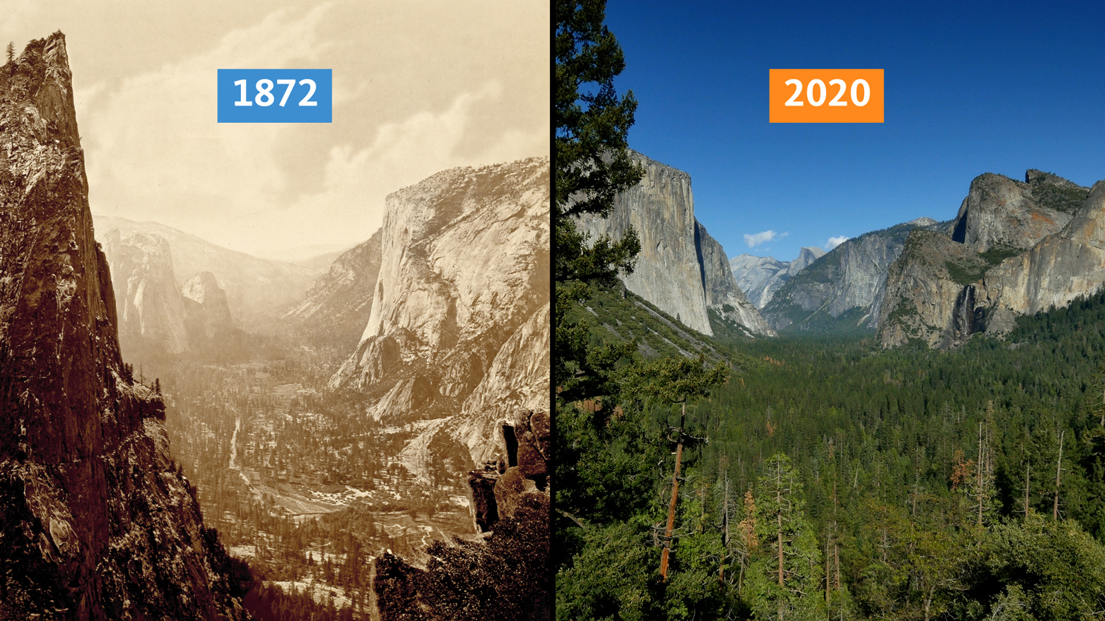
While the introduction of non-native, fire-prone plants and an actively destructive government policy of total fire suppression have increased wildfire intensity and spread, there is no doubt that wildfires in southern California are a natural occurrence due to high velocity winds and a dry climate. In fact, wildfires are a natural process that have evolved over millennia, and play an essential role in maintaining the health and balance of many ecosystems. They’re responsible for ecosystem renewal and nutrient recycling, promote plant adaptations and growth, and maintain biodiversity by providing food and shelter for animals while preventing overcrowding and disease.
Unfortunately, modern society has turned a blind eye to the idea of wildfires as a necessary natural phenomenon, and in doing so has cast itself as a poorly-adapted, wildfire-fueling invasive species that time and again places its settlements in high-risk areas.
Building in the Fire Belt
What are your first thought when you see a house like this? Do you think of the views of the surrounding Santa Monica mountains? Maybe you smile at the privacy from neighbors, or feel comforted by the familiar Malibu real-estate agent’s statement that “crime don’t climb”.
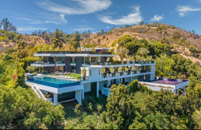
In the early 1930s, Frederick Law Olmsted, Jr.’s thoughts likely would’ve thought the opposite - he would’ve taken issue with the very existence of this house in the first place. The nation’s foremost landscape architect and designer of the California state park system, Olmstead had come out in favor of public ownership of at least 10,000 acres of the most scenic beach and mountain areas between Topanga and Point Dume. Despite a series of fires in 1935, 1936, and 1938 which destroyed almost four hundred homes in Malibu and Topanga Canyon, public officials stubbornly disregarded the wisdom of Olmsted’s proposal for a great public domain in the Santa Monicas.
In fact, in the late 1950s, the Eisenhower administration declared Malibu a federal disaster area and offered blaze victims tax relief as well as preferential low-interest loans, establishing a precedent for the public subsidization of firebelt suburbs that directly links to the $100-billion bill for the latest LA fires. Creating ‘defensible space’ became the government’s new mantra, and it was soon echoed across California in the aftermath of other great fires, such as those that swept San Diego County in 2003 and 2007, burning 4,500 homes and killing 30 people. So instead of a long-overdue debate about the wisdom of rebuilding and the need to prevent further construction in areas of extreme natural fire danger, public attention was diverted into a discussion of the best methods for clearing vegetation (rototillers or goats?) and making homes fire-resistant.
Indigenous Fire Stewardship
While government intervention to prevent the proliferation of homes in fire-prone areas is an important step to reducing the impact of wildfires on humans, there is simultaneously much to be done to restore the natural balance between wildfires and their benefits to the ecosystems they interact with - a restoration that, crucially, must be lead by the firekeepers in Indigenous communities on the West Coast that sustainability tended the land centuries prior to European settlers charting the path to our current situation.
The Honorable Ron W. Goode, Tribal Chairman of the North Fork Mono Tribe estimates that the California canopy is now twice as dense, or more, in places that have been missing fire. “When the Indian was on the land, the canopy was 40 percent or less open,” he says. In that open space, a variety of plants, bushes, and smaller trees, like oak trees, were able to grow. These varied landscapes were more resilient to fire; in today’s forests, once the crowns of the trees catch fire, a blaze spreads rapidly, using the tree canopy as a kind of deadly highway.
Frequent and diversified Indigenous burning coupled with natural ignitions reduced fuel loading, which often lowered the intensity and resultant severity of subsequent fires. As such, burning increased the proportion of fire-adapted vegetation and heterogeneous habitats which greatly reduced the threat of and impacts of non-desired wildfires.
However, Spanish and European settlers outlawed cultural burning practices, and at the beginning of the 20th century, forests were extensively logged, then replanted in dense groves, further shifting delicate balances between trees and open areas, and creating the kind of closely packed forests that can fuel massive, uncontrolled wildfires.
“Cultural burning comes back to what we are burning for, and it’s not burning for acres,” Goode says. “We’re burning to restore the land, restore the resources, restore water. Bring it back to where it can reproduce on its own.”
Another important difference between prescribed burns and cultural burns is their approach to time. The North Fork Mono Tribe puts fire on the land in a decades-long cycle. “We’re burning minimally three times in 10 years,” Goode says. “Then the next 20 years, you’re only going to need to burn once. That’s what we call a 30-year cycle.” During the cycle, older people like Goode, now 71, train younger people on how to perform the burns correctly. Each burner performs this cycle of training and implementation and passes it onto the next.
Sidebar: The Role of Climate Change
“I think climate change is no more than 20 to 25 percent responsible for our current fire problems in the state, and most of it is due to the way our forests are,” said Berkeley Professor Scott Stephens in a recent interview. “Illilouette Basin is one of the few places in the state that actually provides that information, because there is no evidence of changes in fire size or in the severity of fires that burn in the area. So, even though the ecosystem is being impacted by climate change, its feedbacks are so profound that it’s not changing the fire regime at all.”
Conclusion
Now at the end of January, lessened winds mean that the worst of the wildfire evacuations seem to be behind many Californians. As government aid packages begin to be signed and beleaguered residents consider the path to rebuilding their homes, it is essential that every resident of the Greater Los Angeles area consider the previous week’s wildfires not merely as the result of climate change or a once-in-a-lifetime disaster, but instead as the culmination of centuries of flawed policies, ecological imbalances, and societal choices.
Now is the time to reject short-sighted subsidized programs and embrace the ecological benefits of fire through informed practices like Indigenous fire stewardship, and to implement strategies that recognize the land’s inherent fire-prone tendencies in order to build more resilient and sustainable communities.
Sources